
|
|
Eric and Peggy Egli are relatives of Pat Oakes who live in Auburn, California, about 35 miles northeat of Sacramento. Those familiar with the Central Pacific Railroad will know Auburn
as it appears in historical accounts of the construction of the transcontinental railroad. In a conversation with them about the railroad they volunteered to provide some photos of what the old rail line looks like today. Below are their pictures and descriptions. Thanks to both for providing these.
Central Pacific Railroad |
|
|---|---|
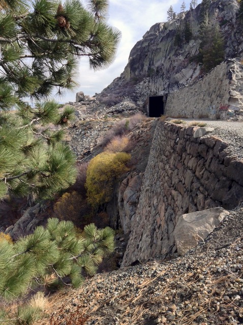
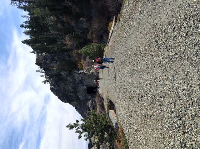
China Wall and Tunnel #8 at Donner Pass. The wall was stacked from the back side by Chinese laborers working 24/7 in a snow cave. Tunnels in this area are no longer active RR track. Nowadays the track goes under Mt. Judah a mile to the south. The newer tunnels accommodate double-decked (= tall) shipping containers. Union Pacific still owns all the old track and has made a few noises about redoing the old tunnels. There’d be a big stink from RR history buffs, I am sure. Some years back when they quit using this track, they removed the old track so they wouldn’t have to pay taxes on the route. There are spots below the old track where you can see piles of old ties. |
|
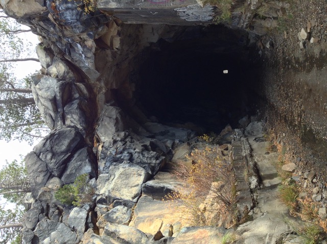
West end of Tunnel #6 by Donner Ski ranch, looking east. Halfway along the tunnel is a vertical shaft which allowed workers to excavate in 4 directions at once. There’s a ton of graffiti in the tunnels. |
|
|
|

|
|
|
|
|
|
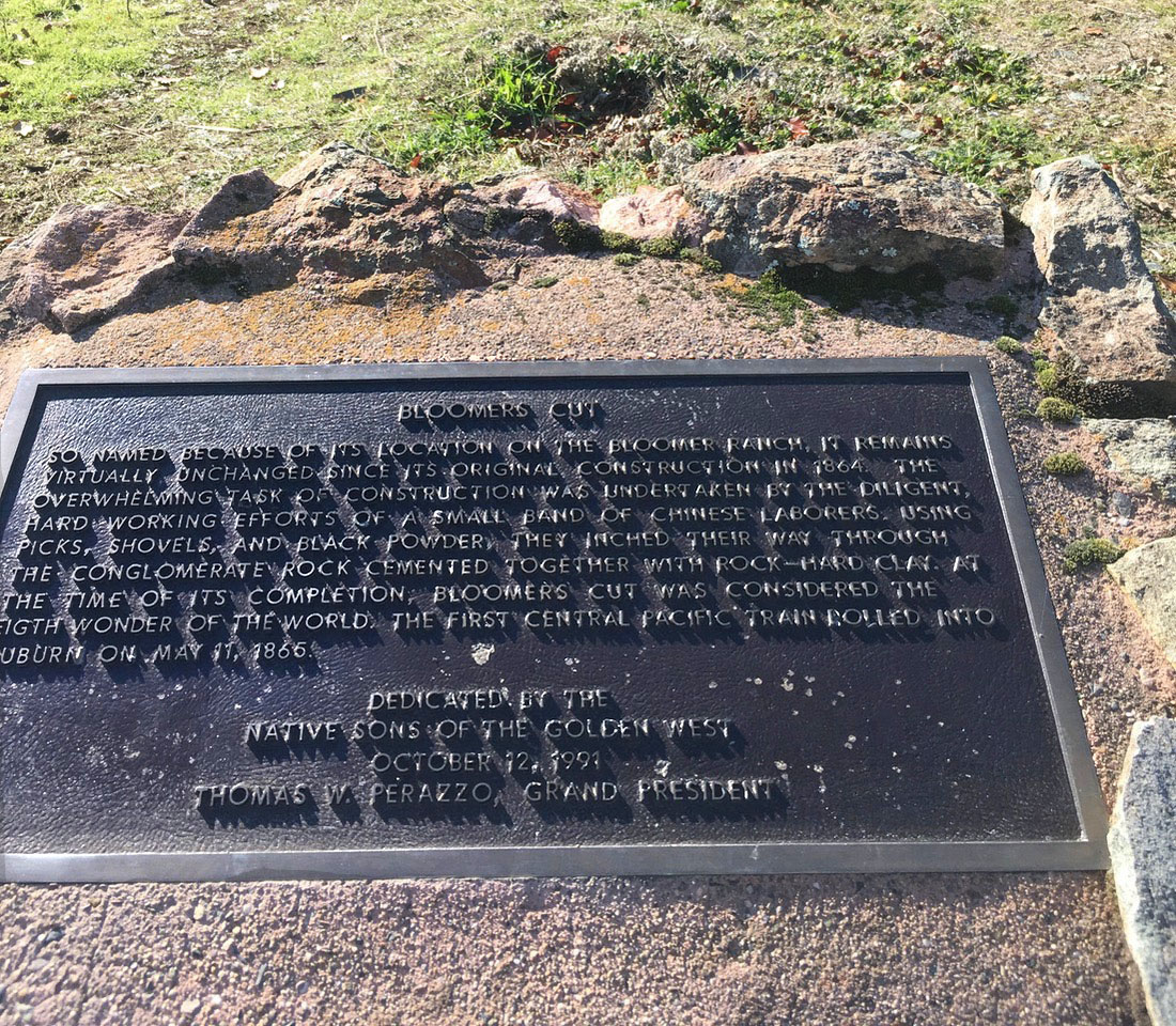
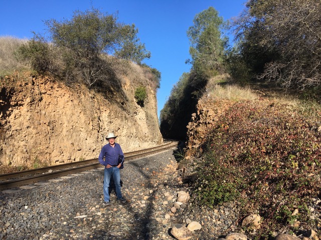
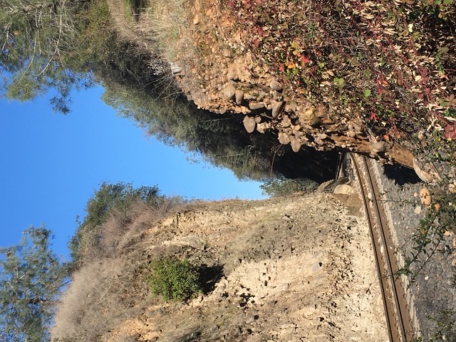
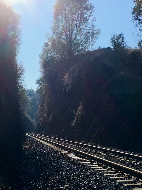
Moving downhill to Auburn... Here’s the historical marker for Bloomer Cut. It’s along the road into a subdivision, but to see the cut requires a 1/3 mile stroll thru empty land between houses. It only took us 19 years to go find it even though it’s a mile walk from home. "Bloomers Cut, So named because of its location on the Bloomer Ranch, it remains virtually unchanged since its original construction in 1864. The overwhelming task of construction was undertaken by the diligent, hard working efforts of a small band of Chinese laborers. Using picks, shovels and black powder, they inched their way through the conglomerate rock cemented together with rock-hard clay. At the time of its completion, Bloomers Cut was considered the eighth wonder of the world. The first Central Pacific train rolled into Auburn on May 11, 186. Erected 1991 by Native Sons of the Golden West, Thomas W. Perazzo, Grand President" |
|
|
|
|
|
|
|
|